From Brunni in the Alptal up to the Rotenfluh
A short tour with four refreshment stops: 5.8 kilometres from Brunni in the Alptal at 1,099 metres up to the Rotenfluh at 1,571 metres. 501 metres of ascent, two hours and an elevation range of 472 metres.
The route from above
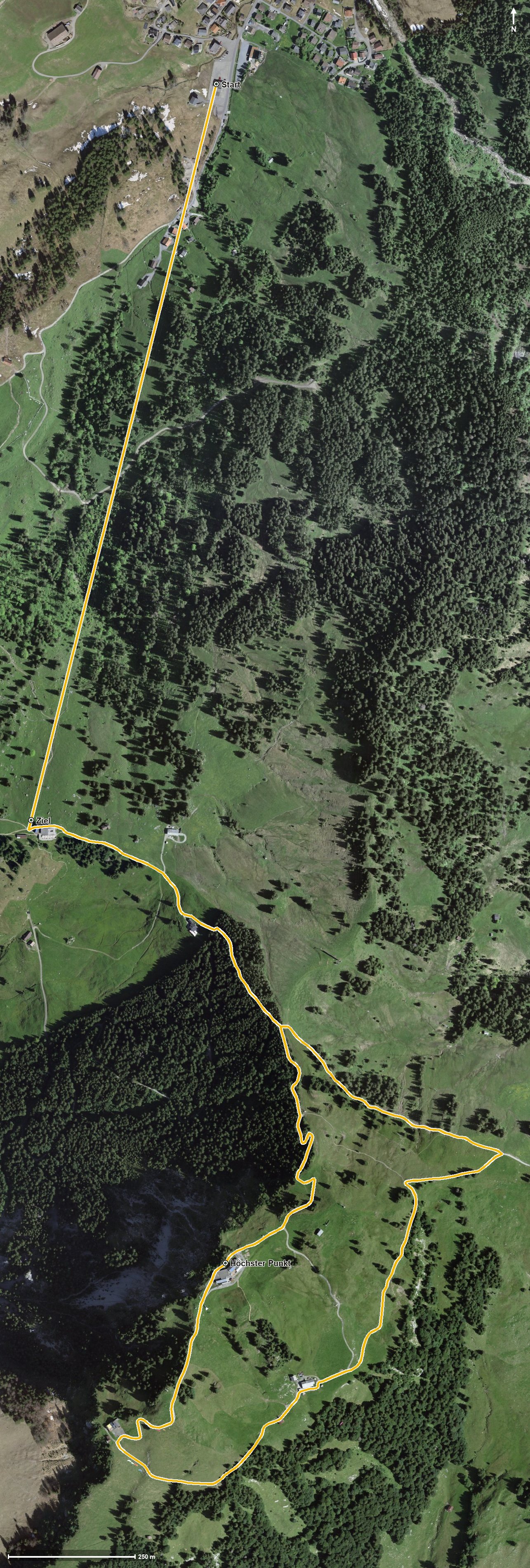
Open interactive map (zoom and pan)
Elevation profile
Route description
The starting point is Brunni in the Alptal at the valley station of the cable car. The steepest passage comes right at the beginning and reaches around 20 per cent. At kilometre 1.5, according to the route data, a cable car bridges the section from 1,099 to 1,398 metres, where the Berggasthaus Holzegg also stands.
From kilometre 1.7 a climb of 159 metres follows. Via the Stäglerenegg saddle and the Zwäckentobel the route continues, and at kilometre 2.8 the Restaurant Gipfelstubli invites you to a break.
At kilometre 2.9 the highest point is reached at 1,571 metres, and shortly afterwards, at kilometre 3.3, the Rotenfluh with the Berggasthaus Rothenfluh. The path continues past the Skihaus Holzegg at kilometre 5.3 and ends at 1,398 metres.
Technically the tour is straightforward; sturdy footwear is enough. It crosses the municipal boundary from Alpthal into Schwyz and can be walked from May to October. As both ends are served by mountain railways, it is easy to plan.
Grading
Good to know
Getting there / public transport
By public transport to Brunni in the Alptal, to the valley station of the cable car. Current timetable at sbb.ch.
Food and drink
Berggasthaus Holzegg at kilometre 1.5, Restaurant Gipfelstubli at kilometre 2.8, Berggasthaus Rothenfluh at kilometre 3.3 and Skihaus Holzegg at kilometre 5.3.
Best time of year
Recommended: May, Jun, Jul, Aug, Sep, Oct