Steep climb from Morschach to Stoos
986 metres of ascent in just under five kilometres, with one passage at a 49 per cent gradient: this climb from Morschach at 641 metres up to Stoos is among the hardest in the collection. 7.5 kilometres, four hours and practically non-stop uphill walking.
The route from above
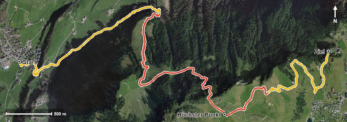
Open interactive map (zoom and pan)
Elevation profile
Route description
The starting point is the village square in Morschach. The climb begins at once and continues until kilometre 4.9, with 986 metres of ascent to overcome. On the way the path leads through the Wissenfluetobel.
The steepest passage lies at kilometre 4.2 and reaches around 49 per cent, in other words in the topmost part, when strength is already flagging. At kilometre 5.0 the highest point is reached at 1,639 metres, high above the Frontal.
The rest of the route leads down over the Hölltobel to the car-free mountain village of Stoos, reached at kilometre 7. The hike ends at 1,275 metres; the elevation range is 999 metres.
Several sections require a sure step and sturdy footwear. No refreshment stop is recorded along the route, but food and drink are available in the mountain village of Stoos at the finish. The funicular is available for the descent. The tour is recommended from April to October.
Grading
Good to know
Getting there / public transport
By public transport to Morschach; the hike starts at the village square. Current timetable at sbb.ch.
Food and drink
No refreshment stop is recorded on the climb. Food and drink are available in Morschach at the start and in the mountain village of Stoos at the finish.
Best time of year
Recommended: Apr, May, Jun, Jul, Aug, Sep, Oct