From Einsiedeln over the Mangelhöhe to Unterägeri
A long high-level hike that divides up well: 19 kilometres from Einsiedeln station at 881 metres across to Unterägeri in the canton of Zug. The 664 metres of ascent are spread over three gentle climbs; the steepest section is 20 per cent.
The route from above
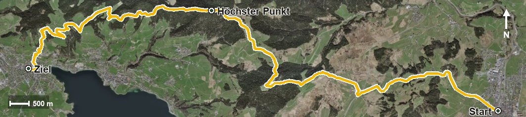
Open interactive map (zoom and pan)
Elevation profile
Route description
The starting point is Einsiedeln station, which makes getting there particularly easy. The path crosses the Wänibach and the Rotenbach and climbs 153 metres to the Katzenstrick over the first 2.5 kilometres.
Via Unter Günzli and the Äussere Altmatt the route continues and gains another 250 metres from kilometre 5.6. At kilometre 7.6 the Alpwirtschaft St. Jost invites you to a break. After the Raten comes the third climb of 115 metres, which leads to the highest point at kilometre 10.9 at 1,208 metres.
At kilometre 12.3 the path crosses the Mangelhöhe, then descends via the Hunntal, Hintertann and the Schneit into the Ägerital. At kilometre 14.0 the Wanderhütte Grümel stands beside the path. After crossing the Lutisbach and the Lorze, the tour ends in Unterägeri at 725 metres.
Technically the route is straightforward, but 19 kilometres call for a decent level of basic fitness. The elevation range is a mere 483 metres, which explains the even profile. The route can be walked from April to October and runs from Einsiedeln via Oberägeri to Unterägeri.
Grading
Good to know
Getting there / public transport
By public transport to Einsiedeln; the hike starts right at the station. Current timetable at sbb.ch.
Food and drink
Alpwirtschaft St. Jost at kilometre 7.6 and Wanderhütte Grümel at kilometre 14.0. Further food and drink are available in Einsiedeln at the start and in Unterägeri at the finish.
Best time of year
Recommended: Apr, May, Jun, Jul, Aug, Sep, Oct