Loop from the Etzelpass
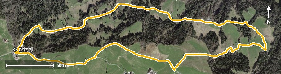
A leisurely loop from the Etzelpass at 954 metres: 6.4 kilometres, 214 metres of ascent and an elevation range of a mere 185 metres. The only climb worth mentioning comes right at the end.
The route from above
Open interactive map (zoom and pan)
Elevation profile
Route description
The starting point is the Etzelpass at St. Meinrad. Right at the beginning the path crosses the Giessenbach, then climbs gently and reaches the highest point of the loop at kilometre 2 at 1,038 metres.
Via the Fuchsloch the route drops to 853 metres and crosses the Schwändibach at kilometre 4.6. Only on the last 600 metres does the only climb worth mentioning follow, 63 metres of ascent back to the starting point.
The steepest passage accordingly comes late, at kilometre 5.9, and reaches around 14 per cent. Technically the hike makes no particular demands. The Gasthaus St. Meinrad stands at the start. The loop is recommended from May to October and crosses the municipal boundary from Einsiedeln into Altendorf.
Grading
Good to know
Getting there / public transport
By public transport to the Etzelpass. Current timetable at sbb.ch.
Food and drink
Gasthaus St. Meinrad at the start and finish of the loop.
Best time of year
Recommended: May, Jun, Jul, Aug, Sep, Oct