A short loop from the Stoos top station to the Stooshorn
2.9 kilometres, 81 metres of ascent and an elevation range of 44 metres: this short loop from the Stoos top station is done in an hour and open all year round. Ideal for a quick outing after the ride up.
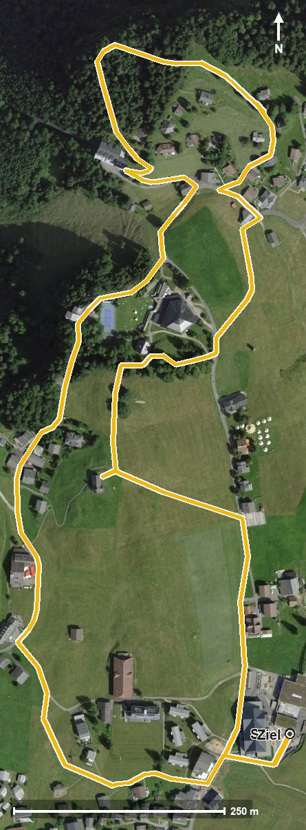
The route from above
Open interactive map (zoom and pan)
Elevation profile
Route description
The starting point is the top station of the Schwyz–Stoos funicular at 1,307 metres, which is also the highest point of the loop. The path runs along above the Frontal and reaches the Stooshorn at kilometre 1.0.
Via the Hölltobel the loop closes back at the starting point. There are no climbs worth mentioning; the steepest section is six per cent.
Technically the route makes no demands; sturdy footwear is enough. Because the loop is open all year round, it is also suitable in the winter half of the year. Food and drink are available in the car-free mountain village of Stoos.
Grading
Good to know
Getting there / public transport
By public transport to Schwyz, then the funicular up to Stoos. Current timetable at sbb.ch.
Food and drink
No refreshment stop is recorded along the loop. Food and drink are available in the mountain village of Stoos at the start and finish.
Best time of year
Recommended: Jan, Feb, Mar, Apr, May, Jun, Jul, Aug, Sep, Oct, Nov, Dec