From Stoos down to Morschach
A pure descent of just under five kilometres: from the car-free mountain village of Stoos at 1,280 metres the path drops 818 metres to Morschach. There are no counter-climbs worth mentioning, which makes the tour one of the easiest links between mountain and valley.
The route from above
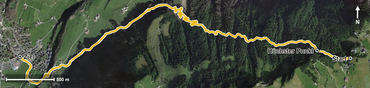
Open interactive map (zoom and pan)
Elevation profile
Route description
The starting point is Stoos at 1,280 metres. After just 400 metres comes the highest point of the route at 1,295 metres, after which it is downhill all the way.
The path leads through a whole series of ravines, among them the Hölltobel, the Summerlaui, the Schorestobel and the Wissenfluetobel, and reaches Morschach at kilometre 4.2 at 648 metres. There are 653 metres between the highest and lowest points.
Technically the hike makes no particular demands; neither a sure step nor a head for heights is needed. Because it is downhill all the way, walking poles are a relief for the knees. The tour is recommended from May to October.
No refreshment stop is recorded along the route. Food and drink are available in the mountain village of Stoos at the start and in Morschach at the finish. The hike stays entirely within the municipality of Morschach.
Grading
Good to know
Getting there / public transport
By public transport to Schwyz, then the funicular up to Stoos. Current timetable at sbb.ch.
Food and drink
No refreshment stop is recorded along the route. Food and drink are available in the mountain village of Stoos at the start and in Morschach at the finish.
Best time of year
Recommended: May, Jun, Jul, Aug, Sep, Oct