Loop from Unteriberg to the Breitplangg
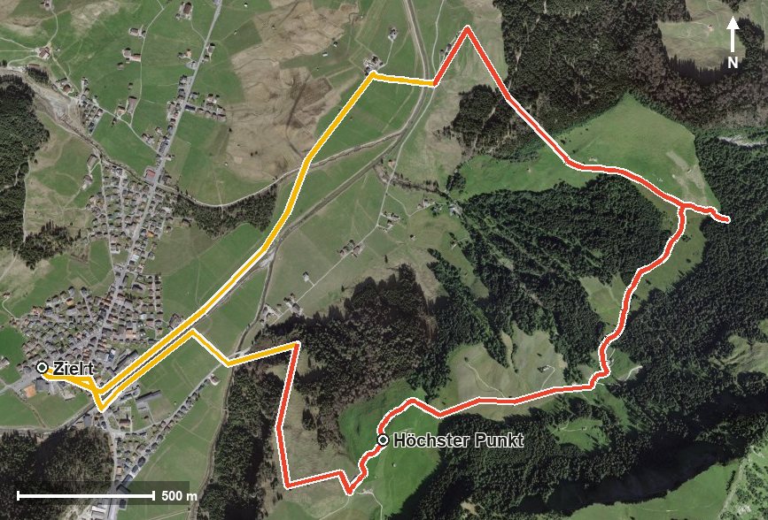
325 metres of ascent in only two kilometres, with a passage at a 40 per cent gradient: this loop starts at the Minster car park in Unteriberg at 930 metres and climbs to 1,251 metres. 7.7 kilometres and two and a half hours.
The route from above
Open interactive map (zoom and pan)
Elevation profile
Route description
The starting point is the Minster car park in Unteriberg at the Stöcken. The path crosses the Minster at kilometre 0.3 and the Waag at kilometre 0.9; the climb of 325 metres begins from kilometre 0.3.
The steepest passage lies at kilometre 1.2 and reaches around 40 per cent. At kilometre 1.5, according to the route data, a lift bridges the section from 985 to 1,127 metres.
At kilometre 2.3 the highest point of the loop is reached at 1,251 metres. The way back leads over the Breitplangg at kilometre 5.4, where another lift descends from 1,107 to 1,015 metres.
After crossing the Nidlaubach at kilometre 6.3 the loop closes back at the starting point. The elevation range is 348 metres. Several sections require a sure step and sturdy footwear. No refreshment stop is recorded along the route. The loop can be walked from May to October.
Grading
Good to know
Getting there / public transport
By public transport to Unteriberg, Guggelstrasse or Herti. Current timetable at sbb.ch.
Food and drink
No refreshment stop is recorded along the loop. Food and drink are available in Unteriberg at the start and finish.
Best time of year
Recommended: May, Jun, Jul, Aug, Sep, Oct