A long loop from Rothenthurm over the Katzenstrick
26.9 kilometres and 1,112 metres of ascent: this full-day tour from Rothenthurm station at 927 metres leads over the Katzenstrick and the Alptal up to 1,565 metres and back. Eight and a half hours with four well-spaced climbs.
The route from above
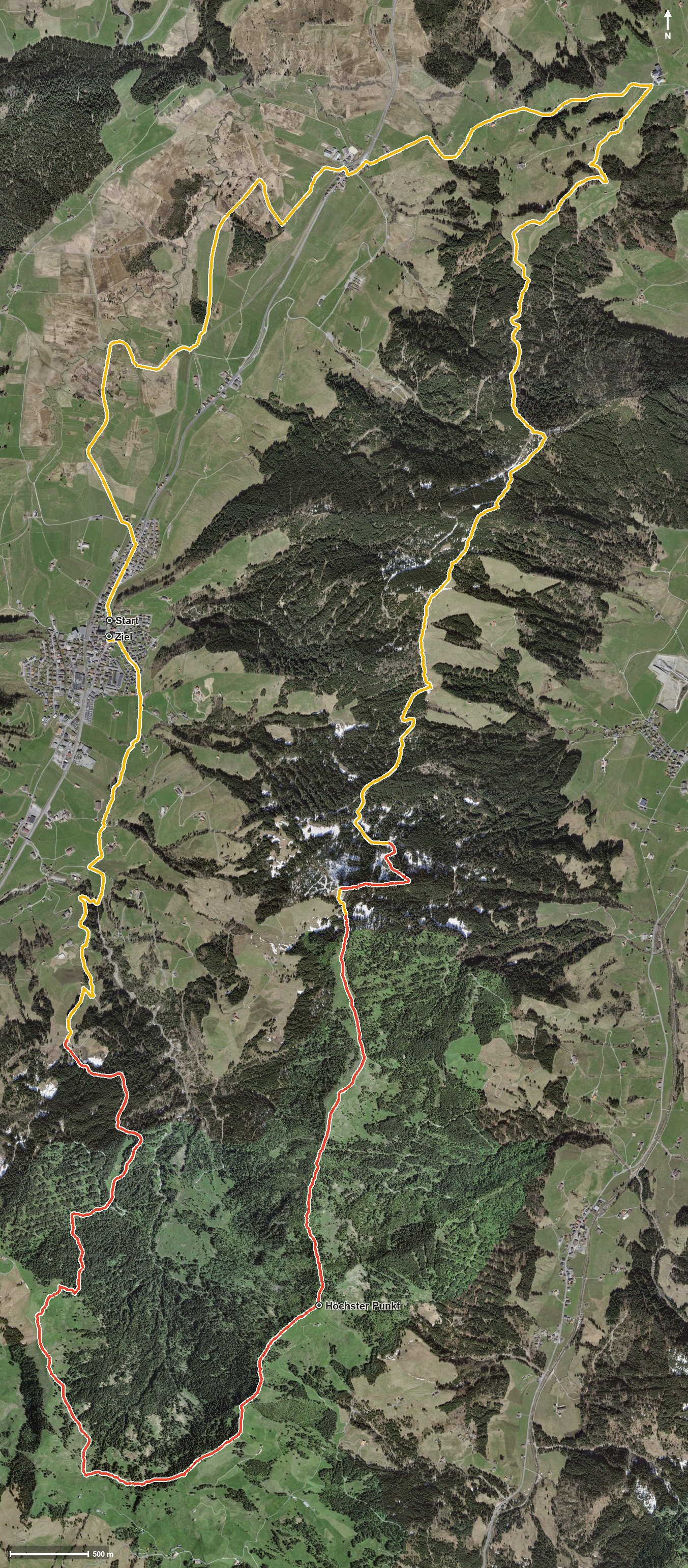
Open interactive map (zoom and pan)
Elevation profile
Route description
The starting point is Rothenthurm station, which makes getting there particularly easy. The first four kilometres run flat through the bog landscape, after which a climb of 259 metres follows from kilometre 4.0.
Via the Äussere Altmatt, the Schlüssel and Unter Günzli the route reaches the Katzenstrick at kilometre 7.2. From kilometre 9.2 the path gains another 218 metres and leads into the Alptal at kilometre 10.8.
From kilometre 12.7 the third climb of 298 metres follows through the Süüloch; the steepest passage is 30 per cent at kilometre 14.1. Via the Pfauentobel, the Vogelwaldtobel and the Chessiloch the highest point is reached at kilometre 17.5 at 1,565 metres.
The long way back leads through the Malosentobel and the Kleine Lauischlucht, via Spitzleren and, after crossing the Schorenbach and the Dorfbach, back to the station.
The elevation range is 661 metres. Several sections require a sure step and sturdy footwear, and the 27 kilometres call for very good fitness and an early start. No refreshment stop is recorded along the route. It can be walked from May to October.
Grading
Good to know
Getting there / public transport
By public transport to Rothenthurm; the loop starts at the station. Current timetable at sbb.ch.
Food and drink
No refreshment stop is recorded along the loop. Plenty of provisions and water belong in the rucksack; food and drink are available in Rothenthurm.
Best time of year
Recommended: May, Jun, Jul, Aug, Sep, Oct