A short circuit from the Mostelberg top station
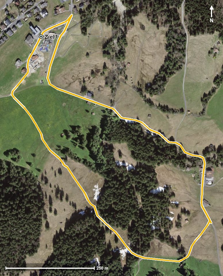
Two kilometres, 52 metres of ascent and an elevation range of 37 metres: this short circuit from the Mostelberg top station is done in half an hour. Two mountain inns along the way make it a leisurely stroll.
The route from above
Open interactive map (zoom and pan)
Elevation profile
Route description
The circuit begins and ends at the Mostelberg top station at 1,181 metres. It leads through the Lauitobel, crosses the Lauitobelbach at kilometre 0.5 and reaches the highest point at kilometre 1.0 at 1,185 metres.
There are no climbs worth mentioning; the steepest section is seven per cent. Technically the route makes no demands; sturdy footwear is enough.
The Berggasthaus Mostelberg at the start and the Berggasthaus Herrenboden at kilometre 0.9 invite you to stop. Because the circuit opens in April and can be walked well into November, it suits a long season.
Grading
Good to know
Getting there / public transport
By public transport to Sattel and on by the Sattel–Mostelberg gondola to the top station. Current timetable at sbb.ch.
Food and drink
Berggasthaus Mostelberg at the start and finish, and Berggasthaus Herrenboden at kilometre 0.9.
Best time of year
Recommended: Apr, May, Jun, Jul, Aug, Sep, Oct, Nov