Over the Pragel from Muotathal into the Klöntal
18.5 kilometres across the cantonal border: this hike leads from Muotathal at 626 metres over a 1,550-metre pass and across into the Klöntal in Glarus. The 984 metres of ascent are spread over two climbs; allow six hours of walking.
The route from above
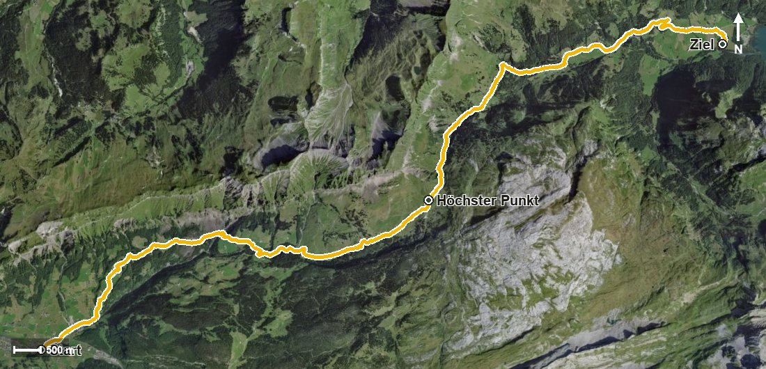
Open interactive map (zoom and pan)
Elevation profile
Route description
The starting point is the rear bridge in Muotathal, where the path crosses the Muota and the Hüribach and passes the entrance to the Hürital. The climb begins at once and gains around 593 metres by kilometre 5.4.
Via the Starzlenbach, the Rotenbach and the hamlets of Egg and Haselbach the route leads through the Horgrasentobel and the Teufdolen. The steepest passage lies at kilometre 1.7 and reaches around 27 per cent.
From kilometre 5.9 another 336 metres of ascent follow through the Hinter Bärenloch to the highest point at kilometre 9.9 at 1,550 metres. On the Glarus side the path descends into the Klöntal, crosses the Chlön at kilometre 10.7 by the Alt Stafel and leads down via the Brüschbach and the Schartlirus.
The hike ends at the Restaurant Plätz at 853 metres, the only refreshment stop recorded along the route. Technically the path remains straightforward, but the length and the metres of ascent call for good fitness. As the start and finish lie in different cantons, it is worth checking the return journey. The route can be walked from May to October.
Grading
Good to know
Getting there / public transport
By public transport to Muotathal; the hike starts at the rear bridge. Current timetable at sbb.ch.
Food and drink
Restaurant Plätz at the finish. Further food and drink are available in Muotathal at the start; no refreshment stop is recorded on the way.
Best time of year
Recommended: May, Jun, Jul, Aug, Sep, Oct