Across the cantonal border: Rigi Kulm to Rigi Kaltbad
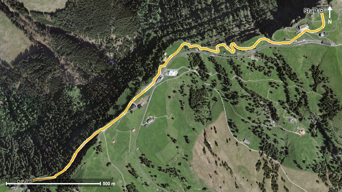
2.2 kilometres without a single metre of ascent: this short route leads from Rigi Kulm at 1,796 metres down to Rigi Kaltbad, crossing the border between Schwyz and Lucerne on the way. Half an hour, open all year round.
The route from above
Open interactive map (zoom and pan)
Elevation profile
Route description
The starting point is Rigi Kulm, which is also the highest point of the route. At kilometre 0.2 stands the Rigi Kulm Hotel, at kilometre 0.4 the Restaurant Kessiboden.
At kilometre 1.1 Rigi Staffel is reached, at kilometre 1.5 the Restaurant Lok 7. The path descends evenly, with the steepest drop at kilometre 1.5.
At kilometre 2.2 Rigi Kaltbad is reached with the Kräuterhotel Edelweiss. The walk ends at 1,557 metres; the elevation range is 241 metres.
Technically the route makes no demands and suits all ages. Because it is open all year round, it is an option in any season. It crosses the cantonal border from Arth into Weggis.
Grading
Good to know
Getting there / public transport
By public transport to Goldau or Vitznau, then the Rigi railway up to Rigi Kulm. Current timetable at sbb.ch.
Food and drink
Rigi Kulm Hotel at kilometre 0.2, Restaurant Kessiboden at kilometre 0.4, Restaurant Lok 7 at kilometre 1.5 and Kräuterhotel Edelweiss at the finish.
Best time of year
Recommended: Jan, Feb, Mar, Apr, May, Jun, Jul, Aug, Sep, Oct, Nov, Dec